
 Buffalo Blueway Sites
Wilkeson Pointe
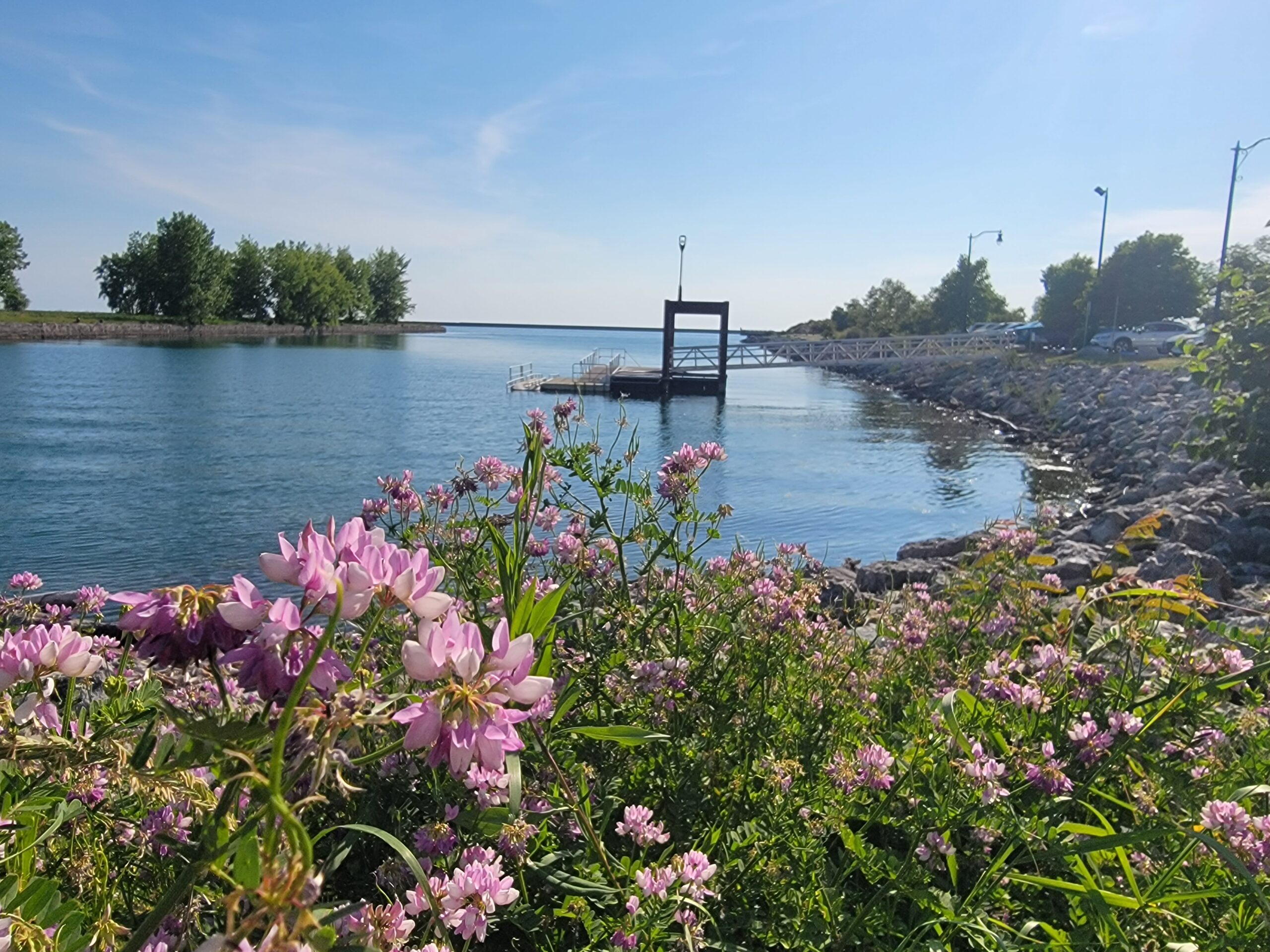
NOTE: For Summer 2024, there is construction ongoing at Wilkeson Pointe and Blueway access is closed. provides a roller launch for easy access and a paddlecraft drop-off area, along with ample on-street parking. Kayak and paddleboard rentals, restrooms and a snack shack are available. This launch facility provides access to paddling in the Outer Harbor—conditions may include exposure to wind and waves. Use caution and stay close to shore. There are very few emergency exits along the Outer Harbor. Launching of motorized vessels is not possible.
225 Fuhrmann Boulevard
Buffalo, NY 14203
Latitude: 42.87074133652292
Longitude: -78.88216444544695


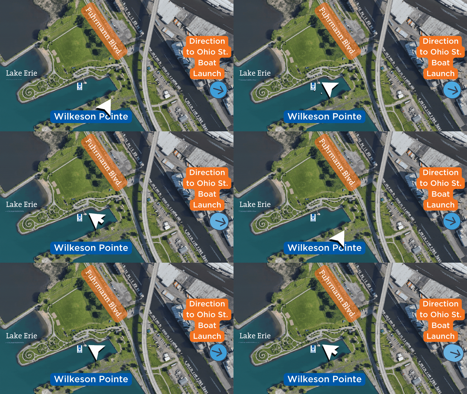
Click to Enlarge
Buffalo Riverworks
Newly enhanced under the Blueway project, the Buffalo RiverWorks site provides paddlers with multiple options for launching and getting out of the water safely and easily. This recently implemented Blueway site boasts a fully accessible paddlecraft roller dock facility on the Buffalo River, as well as additional direct-entry docks and dock sections for transient powerboat access. Kayaks, paddleboards and hydrobikes are available for rent. In addition, parking access is provided for those who bring their own car-top watercraft. Multiple other entertainment options are available at this site, and restrooms can be found inside the restaurant and bar area for patrons. This site is located in a high-traffic area of the river, so it’s critical that paddlers stay along the shore and yield to larger craft.

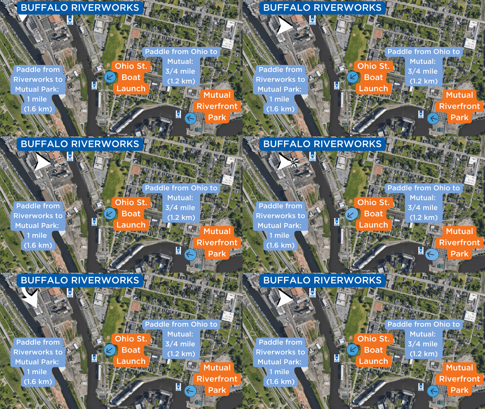
Click to Enlarge
Ohio Street Boat Launch
The newly renovated NYSDEC Ohio Street Boat Launch has been upgraded to be an incredible spot to launch paddlecraft, fish off the accessible fishing pier or sit and watch the lake freighters roll by. A car-top boat launch includes features for carry-in, car-top fishing boat access and paddle craft launching. The fishing pier is wheelchair accessible to allow the pedestrian promenade and pier overlook platform to be accessible to everyone. A new North Path provides pedestrian connections to Ohio Street and the Shoreline Trail.
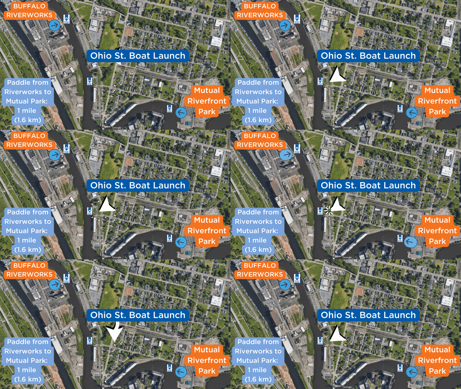
Click to Enlarge
Mutual Riverfront Park
Located on Hamburg Street near the Buffalo River, Mutual Riverfront Park has rain gardens, a heritage center/event space, and a kayak and canoe launch.
Buffalo, NY 14204
Latitude: 42.86452
Longitude: -78.86004

Click to Enlarge
Red Jacket Riverfront Natural Habitat Park
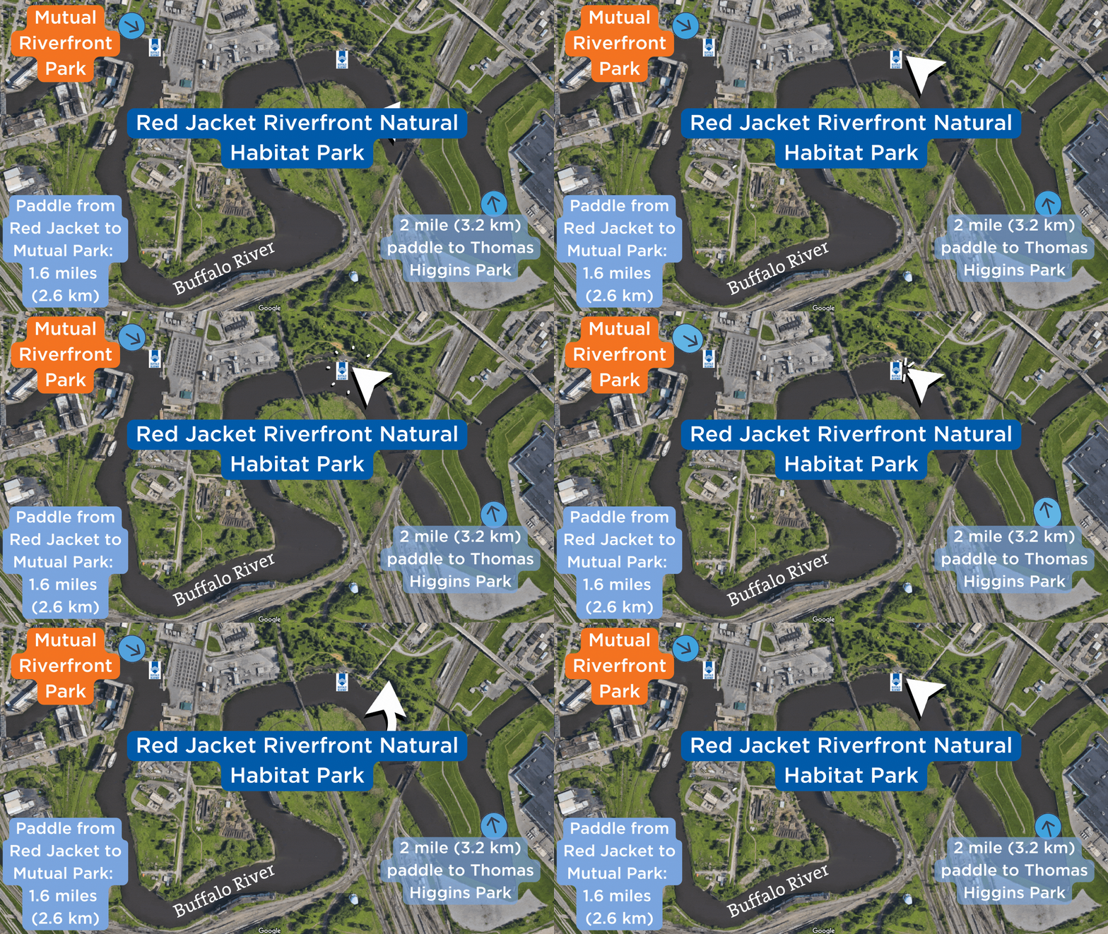
Red Jacket Riverfront Natural Habitat Park is located south of busy South Park Avenue, yet is one of the more remote Buffalo River parks. An informal launch site is located at the western end of the park. There are no docks or concrete pad. There is ample parking available in the park. The site is in a low-traffic area of the channel. Launching of motorized vessels is not possible.
Click to Enlarge
Thomas Higgins Natural Habitat Park (Bailey Peninsula)
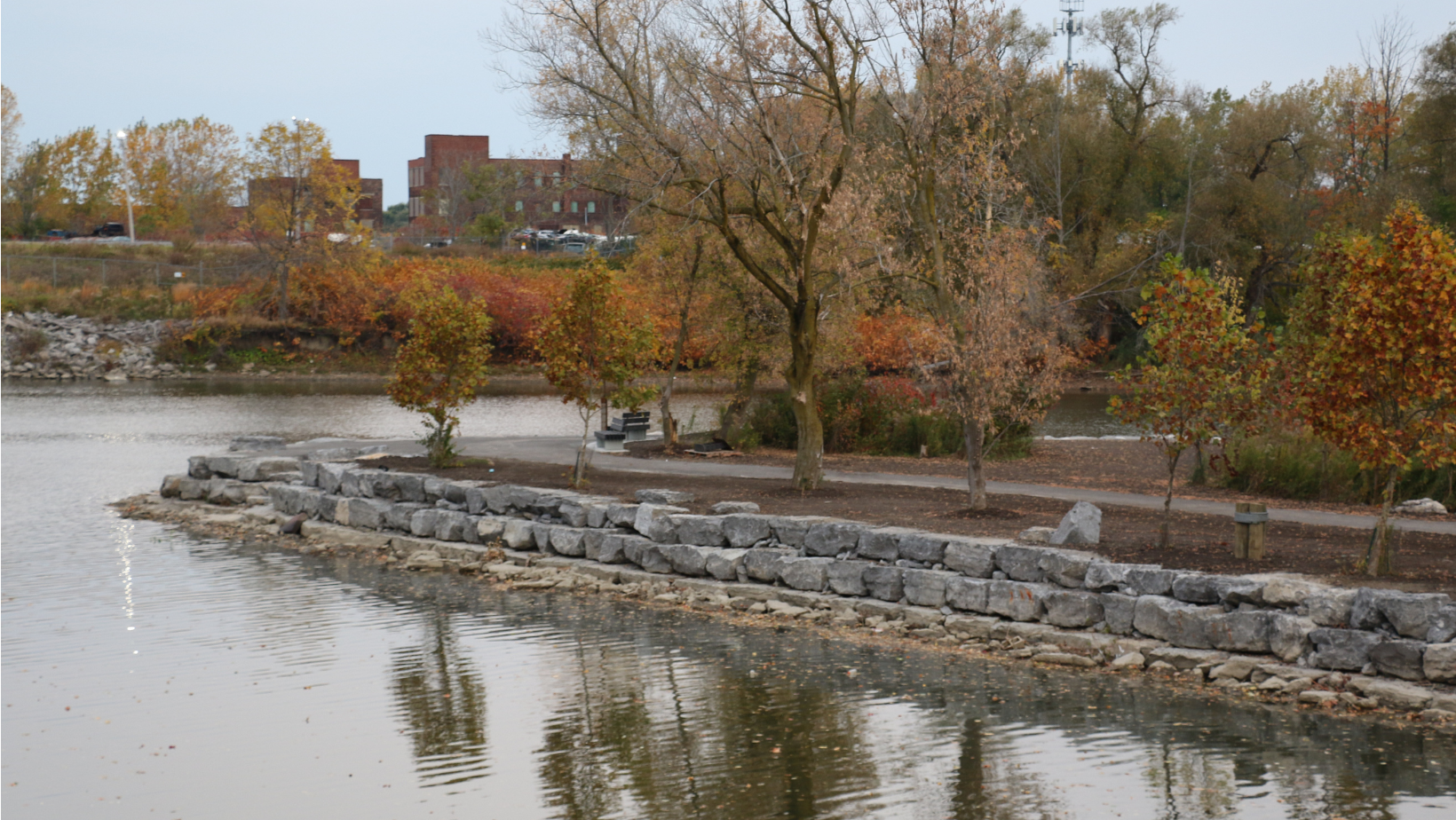
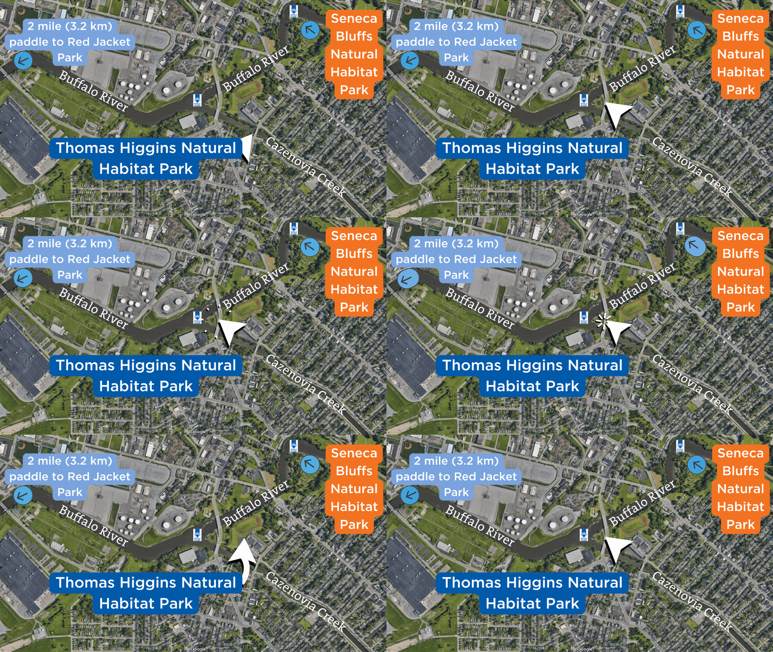
Thomas Higgins Natural Habitat Park (Bailey Peninsula) is located near the Bailey Avenue Bridge at the confluence of the Buffalo River and Cazenovia Creek. This site is owned and maintained by Erie County as an area for passive recreation and fishing. A sidewalk connects the park to a parking lot across the bridge.
Buffalo Niagara Waterkeeper worked with contractors to enhance the park for the community, while also safeguarding its shores from further damage or erosion during winter storms.
Learn more about the upgrades here.
Click to Enlarge
 Future Blueway Sites
Ralph C. Wilson Jr. Centennial Park
Note: Due to major construction to enhance the site, this park is closed to the public.
Centennial Park is a recreational asset for local and regional residents and visitors. Park goers enjoy passive recreation activities as simple as lounging at the water’s edge and taking in the sights of Lake Erie. Centennial Park also offers active recreational opportunities along the waterfront, like festivals, athletic leagues, pick-up games, playgrounds, bicycling and more. The park is currently undergoing a major investment which includes a Buffalo Blueway water access site by 2024.
Seneca Bluffs Natural Habitat Park
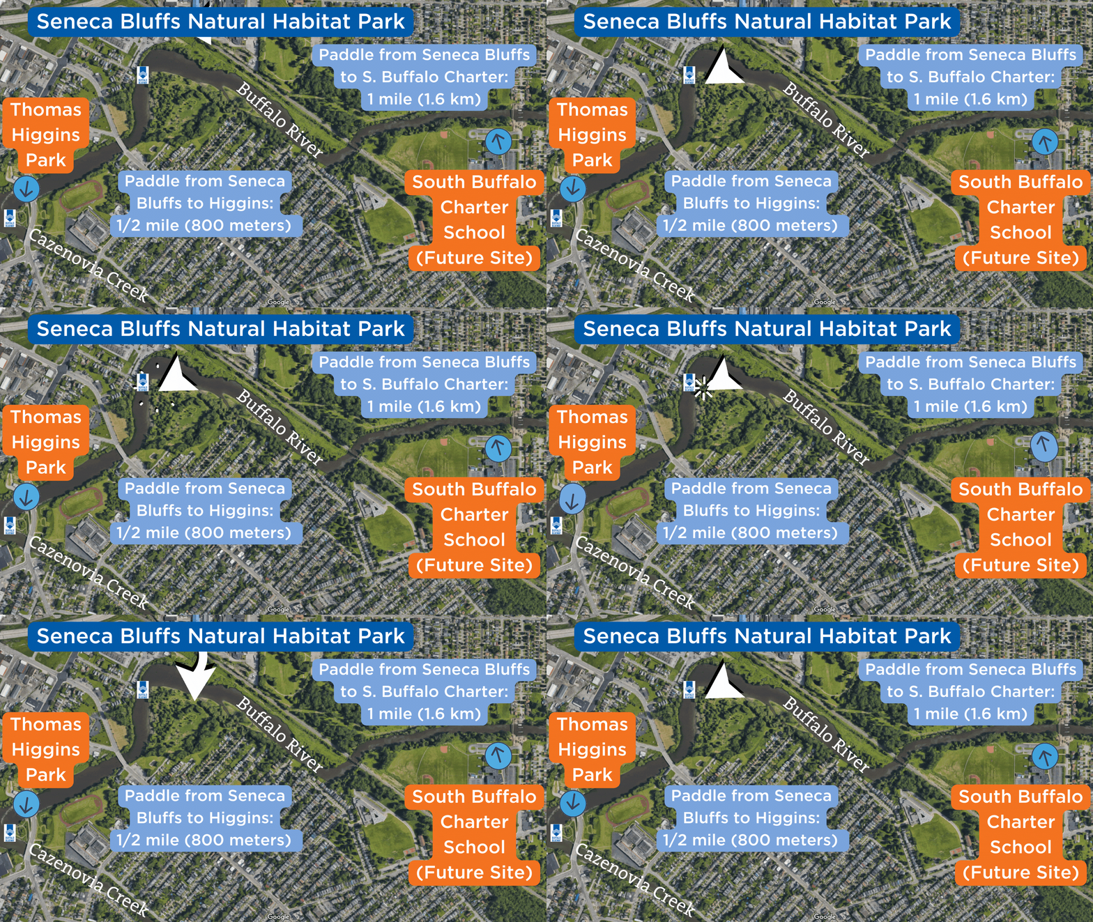
Seneca Bluffs Natural Habitat Park is located near the Seneca Street Bridge. There is an informal launch site with no docks or concrete pad, and ample parking is available in the park. The site is in a low-traffic area of the channel. Because of water levels in this area, launching of car-top and motorized vessels is not possible.
Located near the Seneca Street Bridge, between Elk Street and Avon Place
Buffalo, NY 14210
Click below to see details on future enhancements to Seneca Bluffs.
Click to Enlarge
Harlem Road Fishing Access Point and Launch
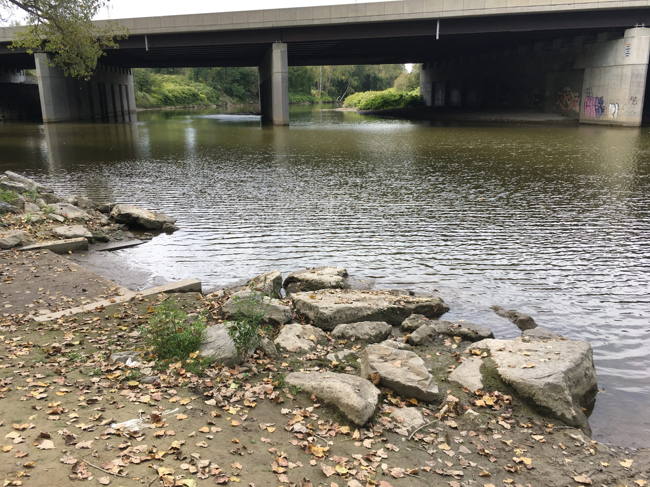
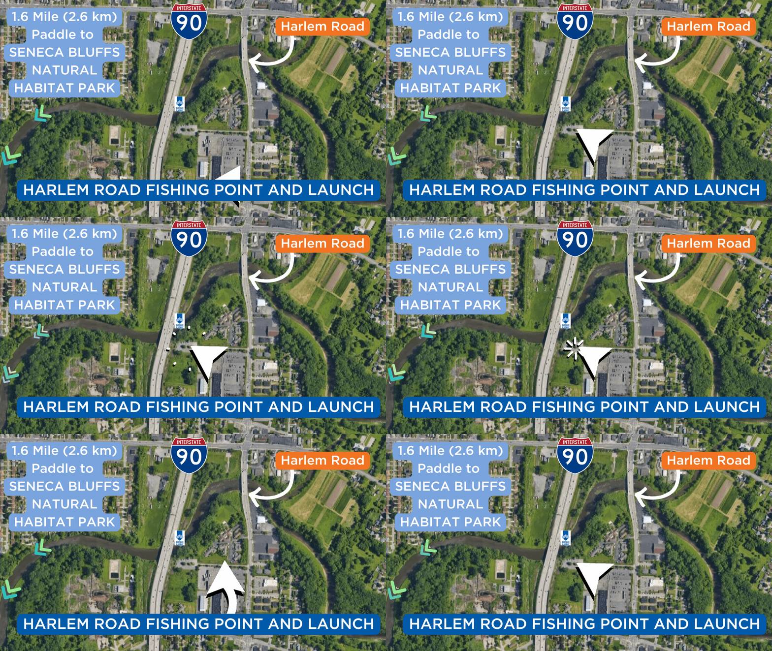
UPDATE: July 1, 2025: This site is closed to the public while construction takes place for improvements. Check back later in the summer for additional details. The NYSDEC Harlem Road Fishing Access Point offers a gravel launch pad with stepped entry into the water, making it easier for launching paddlecrafts. The site provides access to the forested section of the Buffalo River shoreline, with abundant wildlife. Ample parking is available. Launching of motorized vessels is not possible.
Latitude: 42.86781
Longitude: -78.79055
Click to Enlarge
 Parks
Parks
Delaware Park
Delaware Park, designed by Frederick Law Olmsted, is a historic park system and national historic district that includes a 376-acre park.
Unity Island Park
160-acre Unity Island separates the Niagara River and Black Rock Canal. The historic island is home to two public parks and a water treatment facility.
Bird Island Pier
Extending from the southern tip of Unity Island is a long, narrow stone pier called Bird Island Pier. It’s home to a 2.2-mile path with great views of the Niagara River, Lake Erie, the Peace Bridge and the Buffalo skyline.
Front Park
Front Park, designed by Frederick Law Olmsted, is 50 acres with a commanding panoramic view of Lake Erie and the opening of the Niagara River.
Veterans Memorial Park, Buffalo
Veterans Memorial Park is located within the Buffalo and Erie County Naval & Military Park. The park honors veterans who have served in the US military.
Buffalo and Erie County Naval & Military Park Toggle Park
The Buffalo and Erie County Naval & Military Park is a museum on the shore of Lake Erie. It’s home to several decommissioned US Naval vessels.
Times Beach Nature Preserve
Times Beach Nature Preserve is a valuable bird and pollinator conservation site along Lake Erie.
Wilkeson Pointe
Established as a park in 2013, Wilkeson Pointe features naturalized landscapes, a wind sculpture park, a public beach, kayak launches and a beer garden on Buffalo’s Outer Harbor.
Buffalo River Fest Park
Buffalo River Fest Park is a 3-acre public access area for the Buffalo community. The park features boat docks, a wharf, a boardwalk, trails and gardens, an amphitheater and interpretive signage.
Father Conway Park
Father Conway Park on Louisiana Street is perfect for picnicking, field sports and walks to the Buffalo River.
Mutual Riverfront Park
Located on Hamburg Street near the Buffalo River, Mutual Riverfront Park has rain gardens, a heritage center/event space, and a kayak and canoe launch.
Red Jacket Riverfront Natural Habitat Park
Red Jacket Park is located south of busy South Park Avenue, yet is one of the more remote Buffalo River parks. An informal launch site is located at the western end of the park.
Thomas Higgins Natural Habitat Park (Bailey Peninsula)
Thomas F. Higgins Riverfront Park is located near the Bailey Avenue Bridge at the confluence of the Buffalo River and Cazenovia Creek. This site is owned and maintained by Erie County as an area for passive recreation and fishing. A sidewalk connects the park to a parking lot across the bridge. No launch facilities are available, but plans are being developed to allow for paddlesport launching in the future.
Seneca Bluffs Natural Habitat Park
Seneca Bluffs Natural Habitat Park is located near the Seneca Street Bridge. There is an informal launch site with no docks or concrete pad.
Houghton Park
The City of Buffalo park is located adjacent to Houghton Academy and the Buffalo River. The park offers an outdoor swimming pool, playground and walking/running track.
Cazenovia Park
At 83 acres, Cazenovia Park is traversed by Cazenovia Creek. Abundant green space, playing fields, Cazenovia Casino and the Shelter House attract many to the park.
Tifft Nature Preserve
This 264-acre preserve is a notable birding site, with 5 miles of trails through marsh and forest.
Buffalo Harbor State Park
Buffalo Harbor State Park is a 190-acre park and marina on the shore of Lake Erie.
Ship Canal Commons
Ship Canal Commons is at the southern end of Buffalo’s Outer Harbor park system and is the former home to the Hanna Furnace Corporation. The 22-acre interpretive greenspace straddles the canal that pays homage to the site’s industrial past.
Mungovan Park
Located by Southside Elementary School on Southside Parkway.
 Grain Elevators
Connecting Terminal Elevator
The Connecting Terminal Elevator stands on the west side of the City Ship Canal, immediately upstream of its confluence with the Buffalo River.
General Mills Elevator
The Frontier Elevator is one of two operational grain elevators in Buffalo and regularly receives grain shipments from lake freighters for processing in the mill.
GLF Agway Elevator
At top production, the grain mill filled 100 rail cars with hog and cattle feed every day. In 2014, the six silos of the GLF-C Annex were painted blue and wrapped with giant vinyl beer can labels.
Great Northern Elevator
The Great Northern Elevator is a grain storage facility located along Buffalo’s Elevator Alley.
LaFarge (Huron Portland) Cement Elevator
The LaFarge Cement Elevator operates as a cement storage and packing facility. LaFarge handles five types of cement and annually packages about 200,000 tons.
Standard Elevator
The Standard Elevator is one of the most visible of Buffalo’s world-class collection of grain elevators.
Perot Malting Elevator
The Perot Malting Elevator was built in 1907 and serviced the adjacent malt house. Malt was produced on this site from 1907 until recently, providing malt to many Buffalo breweries.
Lake and Rail Elevator and Mill
The Lake and Rail Elevator and Mill was built between 1927 and 1930, and is owned and operated by the ConAgra/Maple Leaf Milling Company. The mill can produce 3.3 million pounds of flour per day.
Marine A Elevator
Marine A Elevator was built in 1925 and has a capacity of more than 2 million bushels.
Concrete Central Elevator
Upon completion, the elevator was a quarter-mile long with a capacity of 4.5 million bushels—the largest grain elevator in the world at the time. Concrete Central closed in 1972.
 Points of Interest
Black Rock Lock
The Black Rock Channel extends from Buffalo Harbor to the Black Rock Lock. The waterway is 3.5 miles long and its navigation channel is at least 200 feet wide at all points.
Mouth of Scajaquada Creek
The mouth of Scajaquada Creek, where it flows into Black Rock Canal, represents many issues and opportunities for the region’s waterways.
Frank Lloyd Wright's Fontana Boathouse
Frank Lloyd Wright designed a symmetrical structure that featured his first perfectly flat roof. In 2007, Tony Puttnam, a Wright apprentice, was selected to make the Fontana Boathouse a reality.
Colonel Ward Pumping Station
In 1900, 60-foot steam pumps were built to deliver water to the City of Buffalo. They were later replaced by smaller, powerful electric pumps, which are still in use.
Buffalo Main Lighthouse
Buffalo Main Lighthouse is located at the mouth of the Buffalo River at the north entrance to Buffalo Harbor.
Commercial Slip
Part of Canalside, the restored Commercial Slip served as the historic juncture between the Erie Canal and the Great Lakes.
Edward M. Cotter Fireboat
Edward M. Cotter is a fireboat in use by the Buffalo Fire Department.
 Bridges
International Railway Swing Bridge
The International Railway Bridge was the fifth bridge built across the Niagara River and the first built to cross the wide, relatively shallow portion of the river above Niagara Falls.
Mouth of Scajaquada Creek
The mouth of Scajaquada Creek, where it flows into Black Rock Canal, represents many issues and opportunities for the region’s waterways.
Peace Bridge
The Peace Bridge is an international bridge between Canada and the United States at the east end of Lake Erie.
Michigan Avenue Vertical Lift Bridge
This bridge was originally built 1930, then knocked down by ship that broke loose of its moorings in 1959. A new lift bridge was built, then rehabilitated in the 1970s and again in 1996.
Ohio Street Vertical Lift Bridge
A bridge has been located on this site since the 1800s. The present bridge is a vertical lift bridge—the entire span is raised by counterweights located in the 135-foot towers on each side.
Twin Bridges: Conrail Bridge and Norfolk Southern Bridge
The Conrail Bridge carries most of the trains that cross the Buffalo River. The bridge is used by a number of railroads. The Norfolk Southern Bridge was closed in 1988 in the upright position.
South Park Avenue Bridge
South Park Avenue Bridge is a vertical lift-through truss bridge over the Buffalo River on South Park Avenue in Buffalo.
Bailey Avenue Bridge
In 2018, this worn-out bridge was replaced and christened as the Sheriff Thomas F. Higgins Riverfront Bridge and Parks.